
 Live Science Plus


Photos: Washington State Landslide's Path of Destruction

Washington Mudslide Before & After

Landslide's Aftermath

This striking photo of the damage caused by the Washington State landslide was captured by DigitalGlobe satellites on March 31, 2014.
Major Disaster

The landslide, which struck on March 22, 2014, devastated the small town of Oso, Wash.

Path of Destruction

The landslide's path is visible in this photo, which was snapped by DigitalGlobe satellites on March 31, 2014.
Lush Hillside

This satellite photo, taken on July 13, 2013, shows the region surrounding Oso, Wash., before it was struck by a deadly landslide on March 22, 2014.
Landslide from Space
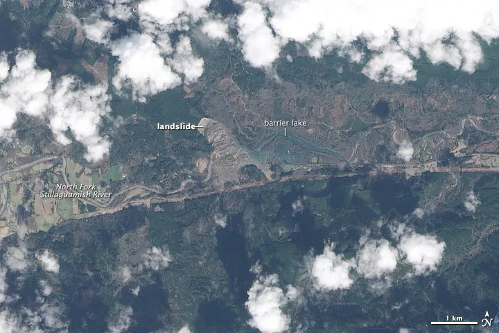
The Operational Land Imager (OLI) aboard Landsat 8 acquired this image on March 23, 2014, showing the devastation from a landslide that struck near Oso, Wash.
Before the Landslide

This satellite image shows the area near Oso, Wash., on Jan. 18, 2014, two months before the landslide.
Deadly Landslide
On March 22, 2014, a deadly landslide struck in Washington State, about 50 miles north of Seattle on the banks of the Stillaguamish River.
Aerial Images

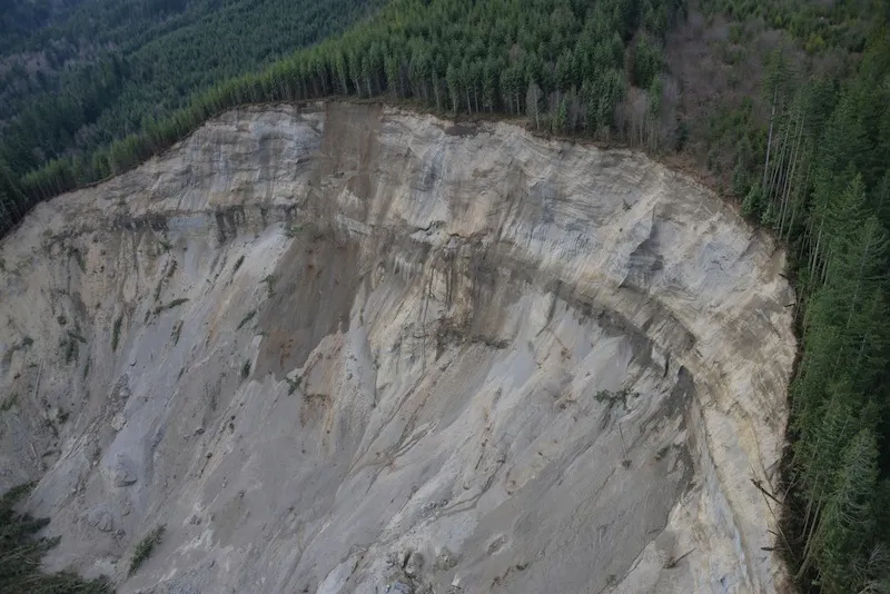
Authorities took images of the landslide site on March 24, 2014, two days after the disaster, during an aerial survey conducted by the Washington State Department of Transportation, Washington State Department of Natural Resources, U.S. Geological Survey and King County Sheriff's Office.
Path of Destruction
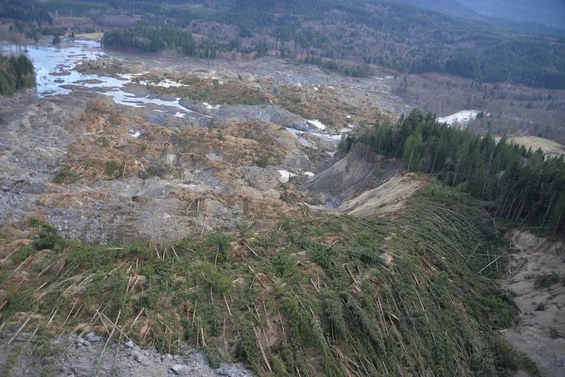
The landslide buried houses and flattened trees near Oso, Wash.
Buried in Mud

Images from the aerial survey show the extent and impacts from the landslide in northwest Washington.
