


Photos: Searching for Ireland's 17th-century 'Pirate Alliance'
Dutchman's Cove
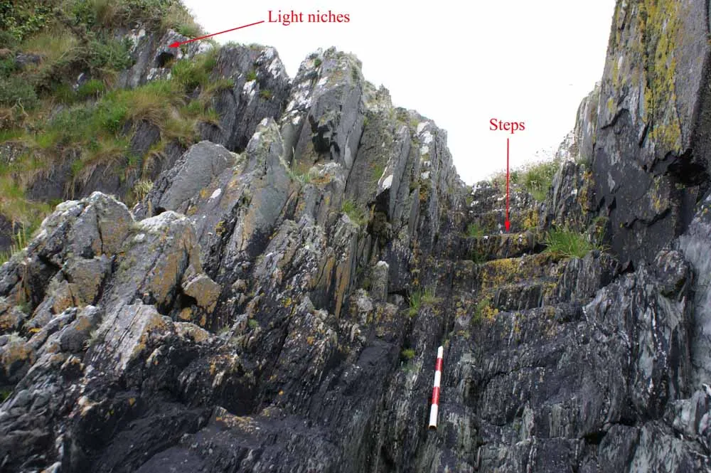
These steps at Dutchman's Cove in Castletownsend, County Cork, Ireland, were carved out of the rock to facilitate illicit trade, in the dead of night, by pirates and smugglers. The niches at the top would have held candles or lanterns to signal them. Underwater archaeologist Connie Kelleher has been investigating piracy in Munster during the early 17th century and surveyed this site as part of her research. While the site appears to have been used by pirates and smugglers it's unexcavated and the date when it was first constructed is unknown. [Read full story]
Gokane Point

Steps cut out of the bare rock on Gokane headland, Crookhaven, West Cork, Ireland; they would have led to a subterranean cavern below that boats can still access. The location of these steps suggests association with piracy and smuggling. Like the site at Dutchman's Cove it is also unexcavated and it is uncertain when it was first constructed. [Read full story]
Coast near Crookhaven

This image of stormy weather hitting the Atlantic coast was taken near Crookhaven, one of the harbors in Munster used by the pirates during the 17th century. In addition to their bases in Ireland, the pirates also sailed seasonally to North Africa and Newfoundland, something that extended their range and allowed them to leave Ireland during periods of inhospitable weather. [Read full story]

James I (VI of Scotland)

In 1603, James I of England (VI of Scotland) ascended the throne, uniting the two countries. He made peace with Spain, outlawed privateering (a practice in which private sailors could get permission from Britain to attack enemy ships) and cracked down on pirates in England's southern ports. As a result many former privateers became pirates and moved with their families to Munster. [Read full story]
Crookhaven

Crookhaven is an important harbor in Munster where the pirates were based. Located near Roaringwater Bay two other important pirate harbors, Baltimore and Leamcon, were located nearby. In 1614 the Dutch attacked a pirate fleet at Crookhaven destroying it and breaking up the pirate alliance. [Read full story]
Castle in Baltimore

Baltimore was another important harbor for the pirates. This castle, known as Du´n na Se´ad, was the primary seat for the chief of the O'Driscolls and eventually became the administrative center for a settlement founded by Thomas Crooke. Both the O'Driscolls and the Crooke had connections to the pirates, facilitating their activities when it suited them. The structure that stands today is a fortified house built by Thomas Crooke. [Read full story]
Skull Harbor

In 1612, as the Dutch were preparing to attack the pirates, they produced a detailed anti-pirate map of the areas the pirates frequented in Munster. One of them was "Schull" now sometimes called "Skull" harbor, pictured here. Leamcon was located near it. [Read full story]
Get the world’s most fascinating discoveries delivered straight to your inbox.

For the science geek in everyone, Live Science offers a fascinating window into the natural and technological world, delivering comprehensive and compelling news and analysis on everything from dinosaur discoveries, archaeological finds and amazing animals to health, innovation and wearable technology. We aim to empower and inspire our readers with the tools needed to understand the world and appreciate its everyday awe.