
 Live Science Plus


Destruction from Above

Since the onset of Syria's civil war, archaeologists have worried about the destruction of the country's rich cultural heritage. In this image from 2012, many looting holes and a military presence are now visible at Tell Jifar, an unexcavated ancient mound.
Tell Jifar, 2007

Some looting holes at Tell Jifar can be spotted in images from as far back as 2007, before the war started.
Apamea's Lunar Landscape

Thousands of looting holes are now visible in Google Earth imagery of Apamea, an ancient Roman city in northwest Syria.
Article continues belowApamea, Before Looting

In stark contrast, this image of Apamea from 2011 shows what the ancient site looked like before it was widely looted.
Tell Qarqur
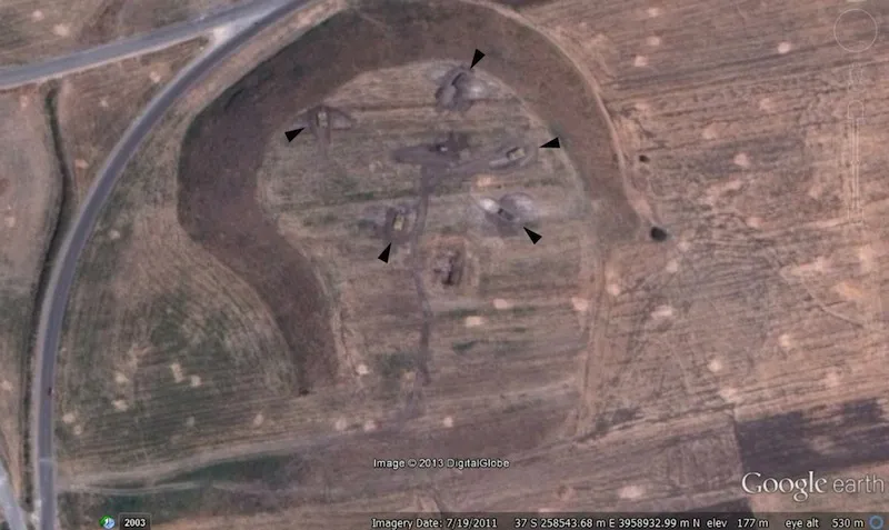
Before civil war broke out in Syria, Tell Qarqur was home to an archaeological expedition. Now military tanks sit inside bunkers carved into the ancient mound.
Dura-Europos

This September 2013 image shows the Palmyrene gate and city wall at Dura-Europos, an archaeological site on the Euphrates River. With the war, the scale and scope of looting both inside and outside the city walls has increased.

