
 Live Science Plus


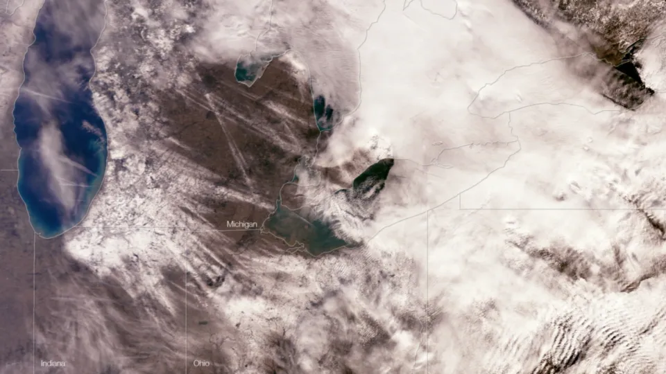
What Lake Effect Snow Looks Like from Space

From NOAA's Environmental Visualization Laboratory:
Streaks of snow crisscross the Great Lakes region after storms blew across the area in the first week of January, and are visible in this NASA MODIS satellite image taken on January 5th, 2012. Lake effect snow results from cold air blowing over large bodies of relatively warmer water, such as the Great Lakes, and often has characteristic banding patterns of clouds or moisture that are visible in satellite or radar imagery. The second image was taken by the NOAA GOES-13 satellite as the system passed over the area on January 3, 2012 at 1515z. The cloud patterns appear to match the resulting snow patterns seen in the MODIS image.
Get the world’s most fascinating discoveries delivered straight to your inbox.
