Satellites Gallery: Science from Above
Get the world’s most fascinating discoveries delivered straight to your inbox.
You are now subscribed
Your newsletter sign-up was successful
Want to add more newsletters?

Delivered Daily
Daily Newsletter
Sign up for the latest discoveries, groundbreaking research and fascinating breakthroughs that impact you and the wider world direct to your inbox.

Once a week
Life's Little Mysteries
Feed your curiosity with an exclusive mystery every week, solved with science and delivered direct to your inbox before it's seen anywhere else.

Once a week
How It Works
Sign up to our free science & technology newsletter for your weekly fix of fascinating articles, quick quizzes, amazing images, and more

Delivered daily
Space.com Newsletter
Breaking space news, the latest updates on rocket launches, skywatching events and more!

Once a month
Watch This Space
Sign up to our monthly entertainment newsletter to keep up with all our coverage of the latest sci-fi and space movies, tv shows, games and books.

Once a week
Night Sky This Week
Discover this week's must-see night sky events, moon phases, and stunning astrophotos. Sign up for our skywatching newsletter and explore the universe with us!
Join the club
Get full access to premium articles, exclusive features and a growing list of member rewards.
Science Satellites
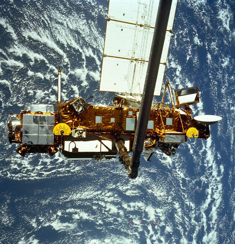
From mapping out the track of a hurricane to monitoring the melting of ice caps, satellites are heavily relied on in science — but sometimes they can go awry. The out-of-control Upper Atmosphere Research Satellite (UARS), which has been languishing in orbit for six years, is now on the verge of falling back to Earth, NASA announced in September 2011. In the above photo, the UARS hangs in the grasp of the Remote Manipulator System during deployment from Space Shuttle Discovery in September 1991.
Upper Atmosphere Research Satellite
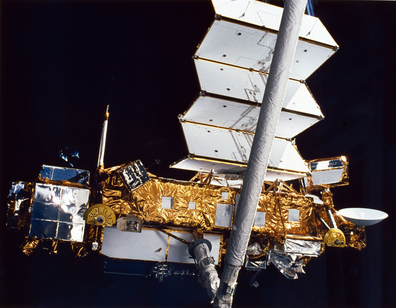
Another shot of the Upper Atmosphere Research Satellite against the blackness of space during deployment from Space Shuttle Discovery in September 1991. The photo was taken while UARS was still under the control of the Remote Manipulator System.
Tumbling Titan
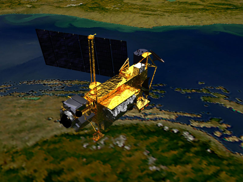
An artist's concept of UARS in space. It was deployed from space shuttle Discovery in 1991 and decommissioned in December 2005. The doomed satellite is a 6 1/2-ton behemoth that will likely break up as it burns through the atmosphere during its Earthward plunge.
Beneath the Sea
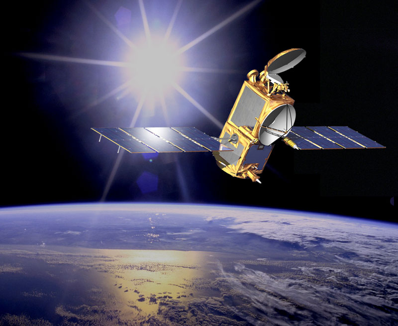
From about 830 miles (1,336 kilometers) above the Earth, OSTM/Jason-2 can measure the height of the ocean's surface directly underneath the satellite with extreme accuracy. On board the satellite, NASA's Global Positioning System receiver and the CNES Doris tracking system provide precise, continuous tracking of the spacecraft’s location. Above is an artist's concept of the OSTM/Jason-2 spacecraft in space.
Weather Forecasts
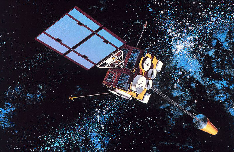
The GOES I was the first of the GOES I-M satellites, which are the primary element of weather monitoring and forecast operations in the U.S. These satellites are key components of NOAA's National Weather Service, operating 22,240 miles (35,790 km) above the Earth. The above graphic shows the GOES-I, the first of the GOES-NEXT spacecraft after a successful launch on April 13, 1994.
Spotting Teens
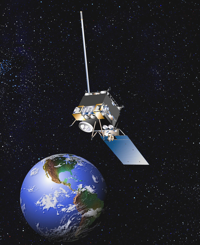
NOAA's GOES satellites can do more than just help monitor and forecast the weather. In July 2011, the GOES 11 satellite helped pinpoint the location of a group of teen hikers in the Alaskan wilderness who had been attacked by a bear and needed emergency medical attention. Above is an artist's depiction of the satellite.
Bumpy Ocean Floor
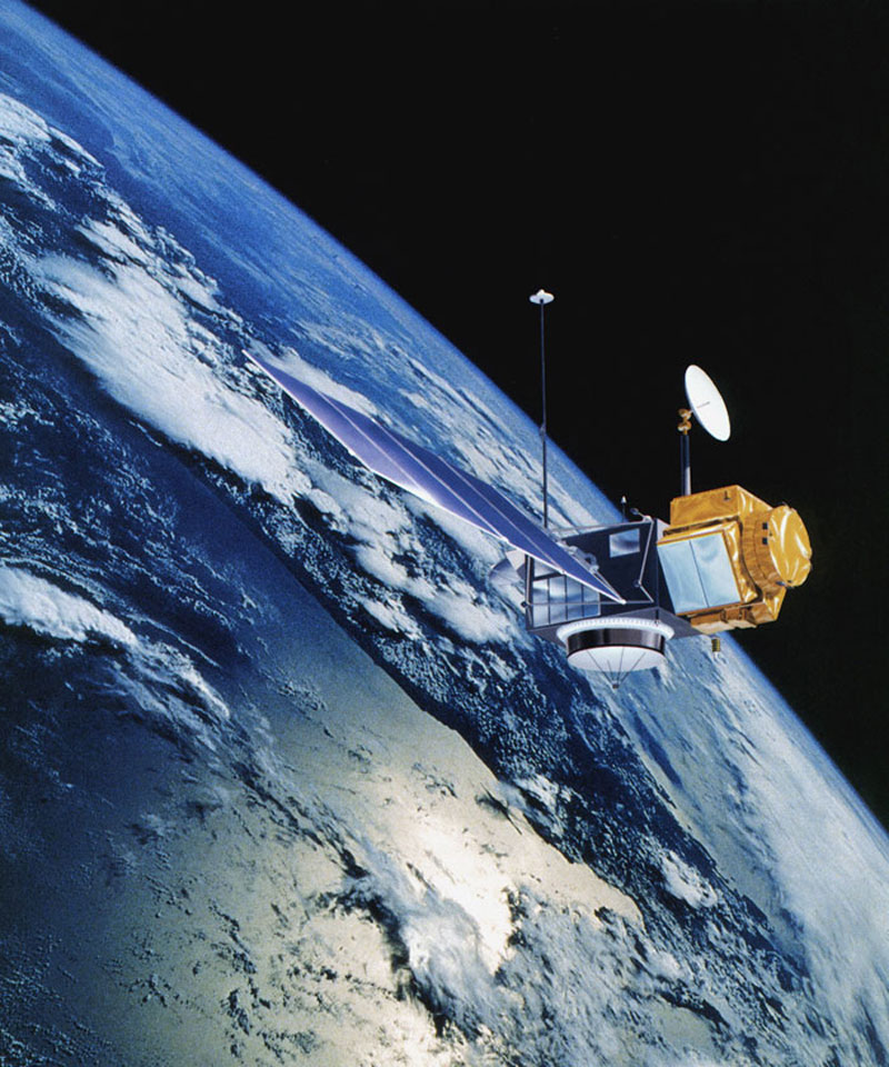
A joint satellite mission between NASA (U.S. space agency) and CNES (French space agency), TOPEX/Poseidon was launched in 1992. The satellite was used to precisely map ocean surface topography until a malfunction ended normal satellite operations in January 2006. Above is an artist's rendering of the satellite.
Get the world’s most fascinating discoveries delivered straight to your inbox.
In Formation
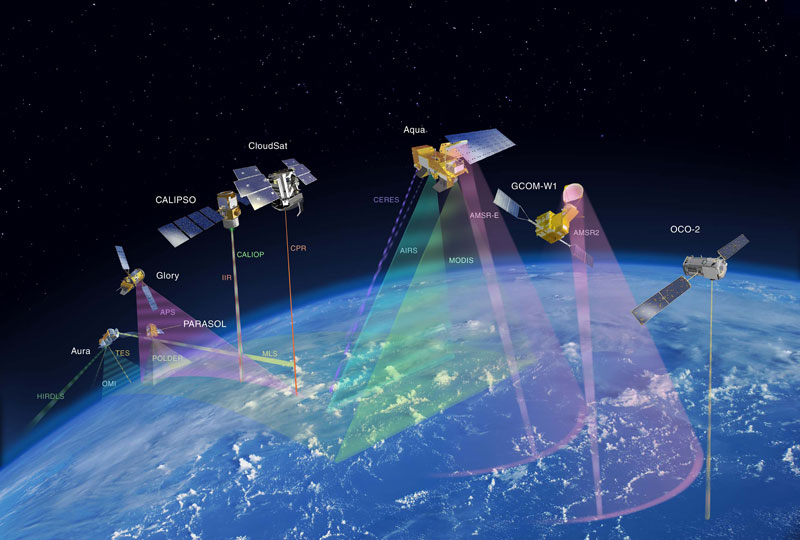
This graphic depicts NASA's A-Train satellite formation, which NASA hopes to have in place by about 2014. The A-Train formation will include the satellites OCO-2, GCOM-W1, Aqua, CloudSat, CALIPSO, Glory, and Aura.
Nimble Satellite
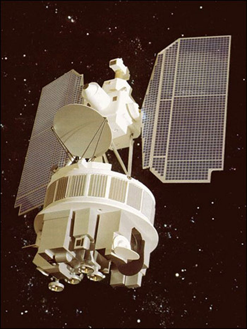
Launched in 1964, the Nimbus-1 satellite began the Nimbus series of missions, which would be the United States' primary research and development platform for satellite remote sensing of the Earth over the next 20 years. Besides sharing its space-based observations of our planet, Nimbus-1 taught NASA scientists about how to improve its technology for studying the Earth from space.
Ocean Circulation Explorer Satellite
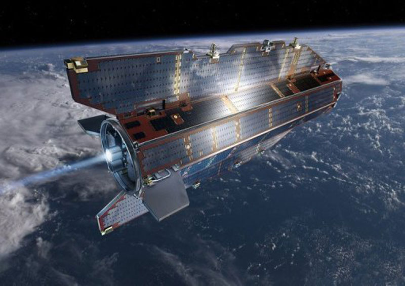
Above is an artist's depiction of the Ocean Circulation Explorer (GOCE) satellite. The European Space Agency's satellite has spent nearly two years in space collecting the raw data necessary to map changes in the Earth's gravity field.
Mapping Precipitation
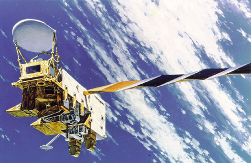
Launched in 2002, NASA's Earth Observing System (EOS) Aqua, shown here as an artistic depiction, is a scientific research satellite that monitors our planet's precipitation, evaporation, and cycling of water as the system orbits around the Earth. It analyzes the state of water on the Earth's surface as well as in the atmosphere.
 Live Science Plus


