
 Live Science Plus


Seismic Waves CAT Scan Maps Inner Earth
A seismological CAT scan one day could lead to a road map of the inside of the Earth, giving geologists a better understanding of the workings of volcanoes and earthquakes.
The seismic wave technology has been applied to one mysterious part of the Earth's mantle in a new study, and the researchers hope to eventually paint a complete picture of the mantle and how it moves.
As a CAT scan uses X-rays to create pictures of the inside of a body, this technique uses seismic waves to measure how the Earth's deep interior slogs around. The motion of the mantle — the layer of solid but hot rock that flows below the planet's crust — controls the locations of continents and oceans, and drives the tectonic plate collisions that shake the surface.

"We hope to create a traffic map of where the freeways and the junctions of the mantle are," study team member Andy Nowacki, a geophysicist at the University of Bristol in England, told OurAmazingPlanet.
Mysterious mantle
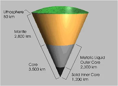
The Earth's mantle is a thick layer of rock beginning 25 miles (40 km) underground that is solid but so scorching hot that it can flow like putty. It is heated from below, so it circulates like water on a stove.
Geophysicists know how the molten material moves by the time it reaches the top of the 1,800-mile-thick (2,900 km) mantle. Here the mantle is sluggish, but drives the motion of the rocky plates on the Earth's surface, which builds mountains, feeds volcanoes and causes earthquakes.
Get the world’s most fascinating discoveries delivered straight to your inbox.
What goes on at the bottom of the mantle, however, is still a puzzle, and researchers need to know how the upper and lower parts of the mantle move to more accurately predict how the Earth's surface will behave over the years.
"It's not going to help us predict volcanoes in Indonesia, but in a much bigger sense, if we understand the heat flow out of the Earth and the structure of the mantle and the core in a longer sense, we'll understand plate tectonics better," said Michael Bergman of Bard College in Simon's Rock, Mass. Bergman, who has written a commentary on this topic for the journal Nature, was not involved with the study.
Seismic CAT scan
The only way to measure the inside of the Earth at such great depths, Nowacki said, is with seismic waves. When a large earthquake occurs and the seismic waves it generates travel through the Earth, they bounce around in different ways, which scientists measure so they can work out what is happening thousands of miles underground.
Nowacki and colleagues used this approach to tease apart how the lower mantle moves in North and Central America. In a few years to a decade, Nowacki said, the team hopes to be able to use this approach everywhere. To make that mantle map a reality, a good seismic network is necessary, Bergman said. When an earthquake strikes Bolivia, for example, scientists need to have seismometers there so that data about those seismic waves can be recorded.
Today's seismic network is spotty: When the 7.0-magnitude earthquake ruptured in Haiti Jan. 12, the country had only one seismometer, which was improperly mounted, the New York Times reported.
The study was detailed in the Oct. 28 edition of the journal Nature.