Clearest-ever seafloor maps show deep-sea 'Grand Canyon' off US coast in stunning detail
By combining high-definition maps with sensors that detect changes in the water column, researchers have created a "centimeter-scale" picture of how currents and tides shape the Monterey Canyon.
A massive deep-sea ravine in the Pacific Ocean has been mapped out in greater detail than any other part of the world's seafloor. The new maps of the "deep-sea Grand Canyon" have a "centimeter-scale resolution" and reveal exactly how the underwater valley is constantly changing.
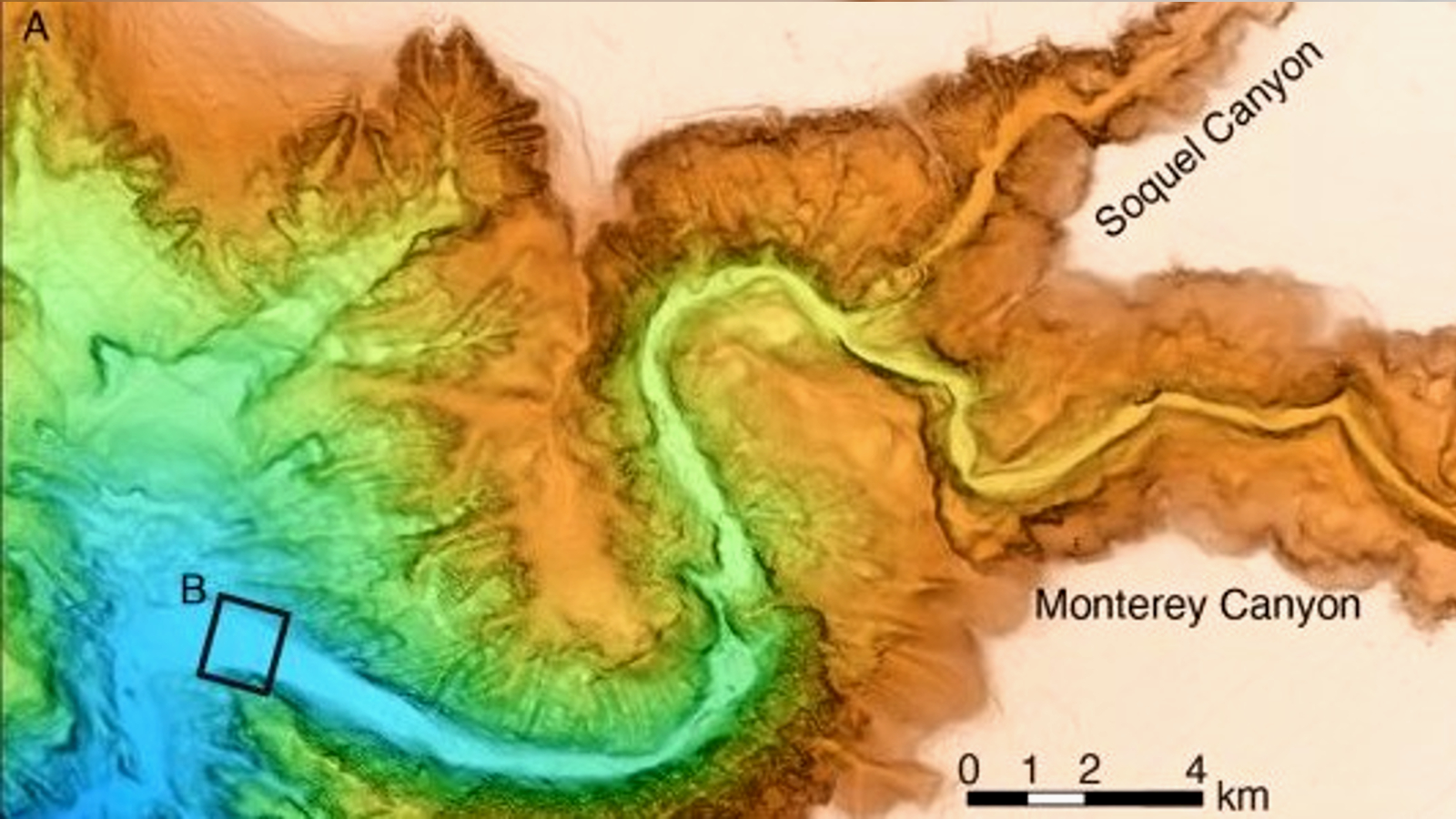
The Monterey Canyon begins just off the coast in Monterey Bay, California. It extends more than 292 miles (470 kilometers) beneath the waves and is around 7.5 miles (12 km) across at its widest point. The underwater ravine has walls up to 5,580 feet (1,700 meters) tall, and at its deepest point the seafloor is around 2.5 miles (4 km) below the ocean's surface.
It is the biggest submarine canyon off the U.S. Pacific coast and has a topography comparable to the Grand Canyon, according to the Monterey Bay Aquarium Research Institute (MBARI).
Related: 'Factorian Deep,' the new deepest point in Antarctica's Southern Ocean, mapped for the first time
To better understand the vast underwater canyon, researchers from MBARI and other research institutes conducted a series of surveys between 2015 and 2017, capturing the valley's seafloor in "remarkable detail." The new surveys provide researchers with a "valuable new perspective to study the processes that sculpt the canyon," study lead author Monica Wolfson-Schwehr, an oceanographer at the University of New Hampshire and a former MBARI scientist, said in a statement.
The results were published April 6 in the Journal of Geophysical Research: Earth Surface.
Constantly changing
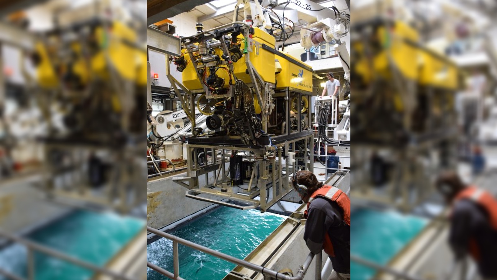
Researchers have long known that the Monterey Canyon's topography varies over time, but until now they have not been able to record these changes happening. Two devices were key to creating the new maps — the Low-Altitude Survey System (LASS), a modified remote underwater vehicle that scans the seafloor as it hovers above it; and the Seafloor Instrument Node (SIN), a recording device that sits on the seafloor and records the movements of currents overhead.
Get the world’s most fascinating discoveries delivered straight to your inbox.
The combined data from LASS and SIN helped the team to track small-scale changes over time, enabling them to "observe a new level of complexity in the seabed" and create a "more complete picture" of what is going on, Wolfson-Schwehr said.
One of the main features studied during the project was fast-moving turbidity currents, which are essentially underwater landslides. These landslides can slather sediment across the canyon floor, filling in troughs and eroding raised features, researchers wrote.
The new data revealed that turbidity currents can move between 2 mph and 7.4 mph (3.2 to 11.9 km/h), but their effects vary across the canyon: The currents appear to cause greater topographic changes in the upper part of the canyon, nearer the coast, and have a reduced impact on the valley floor further out to sea. The maps suggest that large boulders concealed beneath the seafloor in the lower canyon may be reducing the currents' effects.
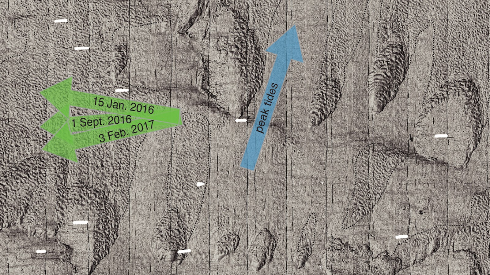
The surveys also showed that tides can play a role in sculpting the seafloor. The ebb and flow of the daily tides carved "small, meter-sized scours" into the seafloor and altered sediment textures on a centimeter scale, which can add up to bigger changes over time, the researchers wrote.
The researchers say that none of the new findings would have been possible without their newly developed equipment. "We didn't realize how much of the picture we've been missing," Wolfson-Schwehr said.
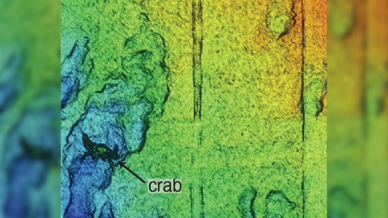
The team believes LASS could also be used to study deep-sea ecosystems as the high resolution of its maps can even pick out individual animals on the seafloor. This could be particularly helpful in studying creatures that are threatened by deep-sea mining.

Harry is a U.K.-based senior staff writer at Live Science. He studied marine biology at the University of Exeter before training to become a journalist. He covers a wide range of topics including space exploration, planetary science, space weather, climate change, animal behavior and paleontology. His recent work on the solar maximum won "best space submission" at the 2024 Aerospace Media Awards and was shortlisted in the "top scoop" category at the NCTJ Awards for Excellence in 2023. He also writes Live Science's weekly Earth from space series.
 Live Science Plus


