
 Live Science Plus


Oil Slick a Mess of Swirls in Satellite Photo

published
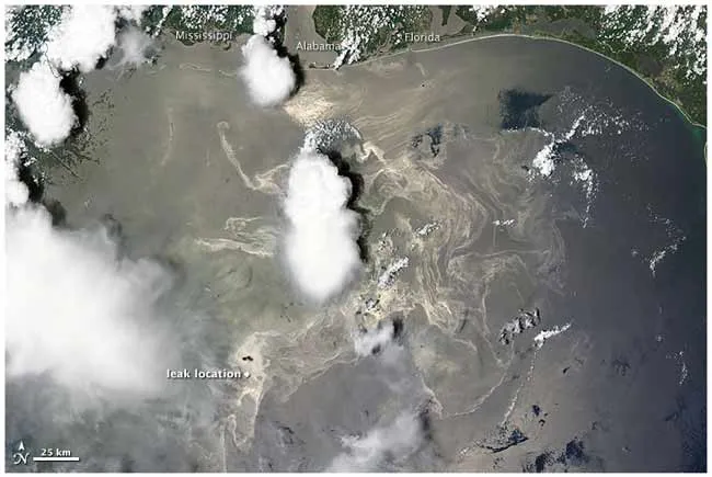
Satellite image of the Gulf oil slick taken on June 19, 2010 by NASA's Terra satellite.
(Image credit: NASA image courtesy the MODIS Rapid Response Team.)

A new satellite image reveals swirls of oil spreading northeast from the leaking Deepwater Horizon well in the Gulf of Mexico.

TOPICS
