
 Live Science Plus


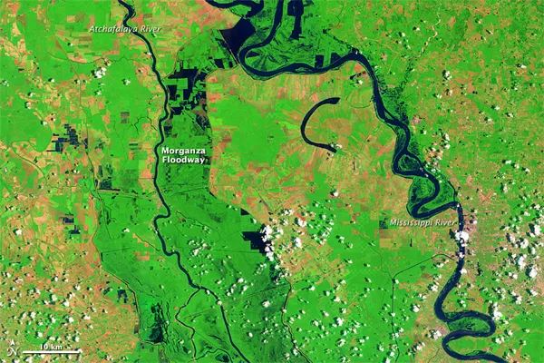
Waters Slowly Recede Along Mississippi

published
(Image credit: NASA/Jesse Allen)
Water levels were slowly receding along the Mississippi and Atchafalaya Rivers in southern Louisiana in early June 2011. Although the Advanced Hydrological Prediction Service of the U.S. National Weather Service reported flooding at several locations in the Baton Rouge area on June 14, flood levels were moderate at most, and river levels were projected to continue falling over the next few days.
The June 2011 image shows flooding along the Mississippi River and water in the Morganza Floodway. The U.S. Army Corps of Engineers opened the floodway in May 2011 to divert excess flood waters from the Mississippi River to the Atchafalaya Basin.


