Spy satellite images taken in the 1960s and declassified in the 1990s have been used to find ancient settlements in Syria.
The sites are near the ancient fortress of Jebel Khalid, which was established in the wake of conquest of Western Asia by Alexander the Great in the third century BC.
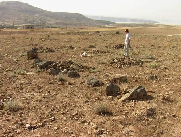
Work led by Ph.D. student Mandy Mottram of the Australian National University uncovered early Islamic pottery factories, mounds of artifacts from 130,000 years ago, and a hilltop complex of megalithic tombs in Euphrates River valley, northeast of the Syrian city Aleppo.
Latest Videos From
The tombs are similar to chambers of stone called dolmens that are found in Europe.
"The dolmen site in particular is a significant find, because in other parts of the Middle East these structures are usually associated with Bronze Age pastoral peoples,” Mottram said. "Nomadic and semi-nomadic pastoralists [shepherds] leave very few archaeological marks, so the find will help us to understand the interplay between pastoralists and farmers at that time."
Images: Overview | Detail | On the Ground
The satellite images, from the United States’ CORONA program, were made in the late 1960s. The researchers looked for minor variations in slope, vegetation and soil color "that may not seem significant on the ground, but which become instantly recognizable when photographed from above," explained David Menere, a member of the survey team.
Since the scientists have been exploring the region for years, they know what to look for, and after matching discoveries on the ground to features in satellite images, they can then examine the images for hints of more ancient remains.
You might think modern satellite images, which have higher resolution, would be more useful. Not always.
"CORONA images have two significant advantages," Menere told LiveScience. "They are of high enough resolution to show most human disturbance of any significance, and they were taken several decades ago, before agricultural development and the growth of towns and roads destroyed or obscured many sites."
More to come
The old satellite photos will likely yield more discoveries, but there is a significant limitation: CORONA did not photograph the entire globe.
"The area had to have been of interest to U.S. intelligence during the period 1960-1972, and preferably covered late in this period," Menere said. "The resolution steadily improved during this time interval, so that by the late 1960s, the images could resolve down to about 2 meters [6 feet]. And of course, no clouds."
Further work by Mottram's team aims to establish a record of human occupation in the Jebel Khalid region from the first arrival of early human groups between 1 million and 700,000 years ago to Ottoman times.