
 Live Science Plus


Images: Undersea Search for Clues of Dinosaurs' Demise

comet impact caused dinosaur extinction

Some 65 million years ago, a space rock crashed into Earth near what is now the Yucatan Peninsula of Mexico. The result likely wiped out the dinosaurs. The ancient impact created a huge crater that is buried under piles of debris and marine sediments. As such, little research has been carried out on these rocks. All existing samples of impact deposits close to the crater have come from deep boreholes drilled on the Yucatán Peninsula, say scientists at the Monterey Bay Aquarium Research Institute.
Now the MBARI scientists say they have found evidence that remnants from the comet crash are visible along a huge underwater cliff called the Campeche Escarpment in the southern Gulf of Mexico.
Campeche Escarpment

This map shows the Gulf of Mexico and the locations of the Campeche Escarpment and the buried impact crater, which scientists think was left by an asteroid or comet that caused a global extinction event about 65 million years ago. In March 2013, scientists aboard a research vessel used multi-beam sonars to create the first detailed map of the Campeche Escarpment.
NOAA Sounding Methods

This image depicts three different sounding methods. Sailors would use a lead line when coming into port to keep an eye on how shallow the water was getting and what type of bottom material it was. Single beam sonars increased coverage of soundings along the track of the vessel, and multibeam sonars increase the soundings both along track and across track. Modern survey vessels can cover a lot more (ocean) ground.
Article continues belowCretaceous Clues

Researchers think these undersea cliffs may hold geological clues to the dinosaurs' demise. This close-up image of the Campeche Escarpment from the 2013 sonar survey shows the proposed contact between rocks of Cretaceous age (below) and younger rocks (above).
Ancient Undersea Rocks

This close-up image of the Campeche Escarpment from the 2013 sonar survey shows a layer of resistant rock that researchers believe may contain rocks formed during an impact event 65 million years ago.
Campeche Cliffs Go Online
Detailed underwater views of the Campeche Escarpment are now available to researchers and the public on Google Earth and Google maps.
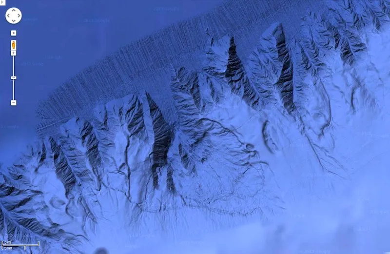
Underwater Landscape

Overview of bathymetry of the Campeche Escarpment as mapped by the R/V Falkor.
Sonar Mapping

Control screen for the multi-beam sonar system used on board the R/V Falkor.
