Gallery: The Incredible Eruption of Mount St. Helens
Mount St. Helens
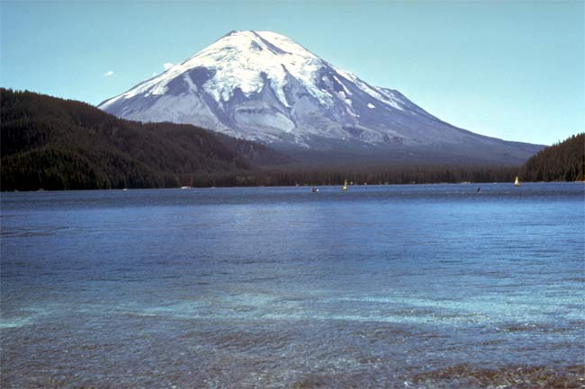
Before the devastating May 18, 1980 eruption, Mount St. Helens was considered one of the most beautiful and most frequently climbed peaks in the Cascade Range. Spirit Lake was a vacation area offering hiking, camping, boating, and fishing.
Mount St. Helens
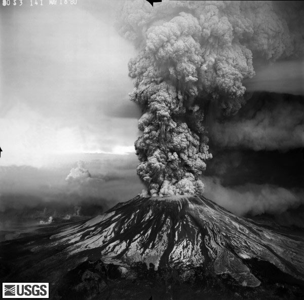
The May 18 eruption sent volcanic ash, steam, water, and debris to a height of 60,000 feet, while the mountain lost 1,300 feet of altitude. Fifty-seven people were killed or are still missing. USGS Photograph taken on May 18, 1980, by Robert Krimmel.
Mount St. Helens
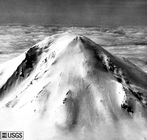
Seismic activity beneath Mount St. Helens began on March 20, 1980, after a quiet period of 123 years. Even so, an overflight of the majestic volcano revealed no unusual features, other than several tracks of earthquake-triggered snow avalanches. Careful observation on the afternoon of March 24, when this aerial view of Mount St. Helens’ summit was captured, showed no evidence of fracturing (a sign of an eruption).
Mount St. Helens
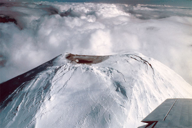
Seven days later, on March 27, small steam explosions (called phreaticexplosins) began. This view of the first crater is from the north.
Mount St. Helens
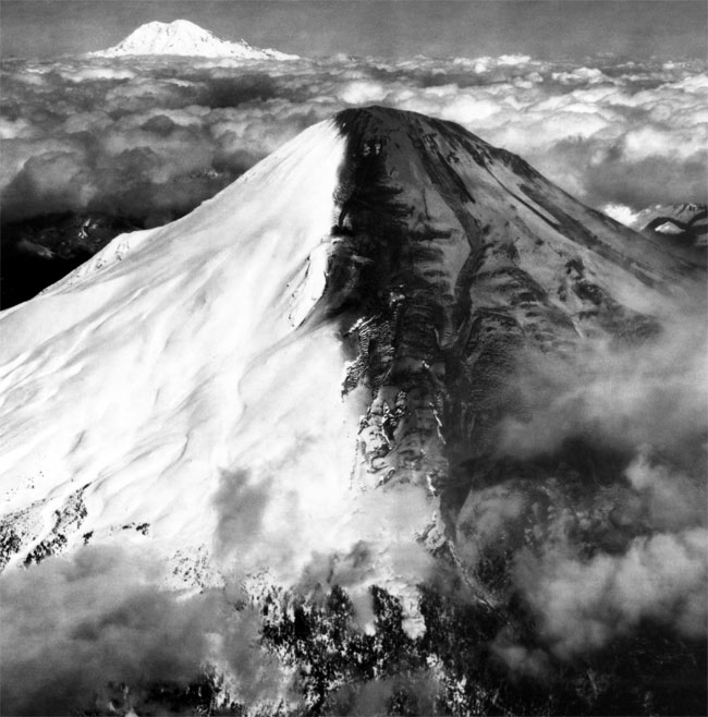
Due to the wind direction, ash from the explosions covered the right portion of Mount St. Helens, while leaving the left portion of the cone ash-free. Snowstorms later covered these ash layers, which in turn were covered by new ash, resulting in alternating layers of ash and snow. Mount Rainier seen in the distance. Image taken on March 30, 1980 by Robert Krimmel, USGS.
Mount St. Helens
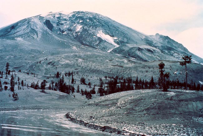
A "bulge" developed on the north side of Mount St. Helens as magma pushed up within the peak. Measurements suggested the bulge was growing at a rate of up to 5feet (1.5 meters) per day. By May 17, part of the volcano's north side had been pushed upward and outward more than 450 feet (135 meters). This image, a view is from the northeast, was taken on April 13, 1980 by Austin Post, USGS.
Mount St. Helens
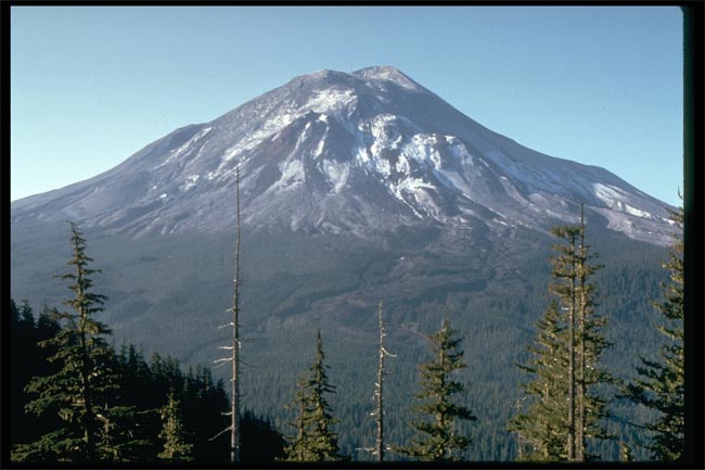
Mount St. Helens on May 17, 1980, one day before the devastating eruption. The view is from Johnston's Ridge, six miles (10 kilometers) northwest of the volcano. USGS Photograph taken on May 17, 1980, by Harry Glicken.
Get the world’s most fascinating discoveries delivered straight to your inbox.
Mount St. Helens
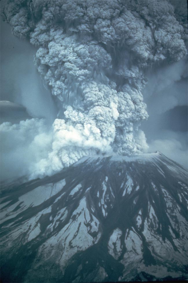
On May 18, 1980, at 8:32 a.m. local time, a magnitude 5.1 earthquake shook Mount St. Helens. The bulge and surrounding area slid away in a gigantic rockslide and debris avalanche, releasing pressure, and triggering a major pumice and ash eruption of the volcano. The results was 1,300 feet (400 meters) of the peak collapsed or blew outward.
Mount St. Helens
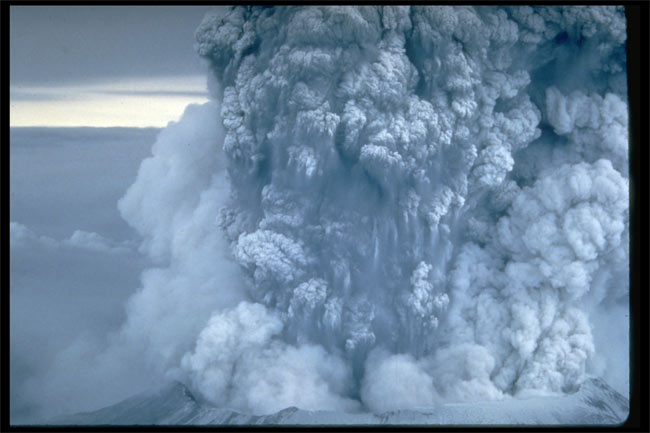
For more than nine hours a vigorous plume of ash erupted, eventually reaching 12 to 15 miles (20 to 25 kilometers) above sea level. The plume moved eastward at an average speed of 60 miles per hour (95 kilometers per hour), with ash reaching Idaho by noon. Shown here is a close-up view of the May 18 ash plume.
Mount St. Helens
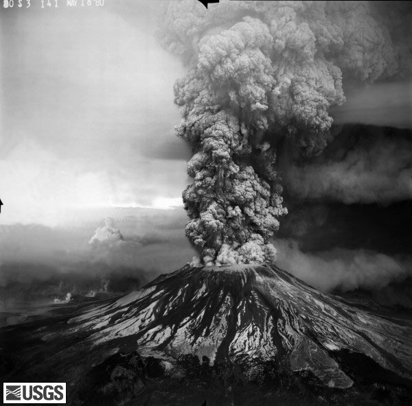
The May 18 eruption sent volcanic ash, steam, water, and debris to a height of 60,000 feet (18,288 meters), while the mountain lost 1,300 feet (396 meters) of altitude. Fifty-seven people were killed or are still missing. USGS Photograph taken on May 18, 1980, by Robert Krimmel.
Mount St. Helens
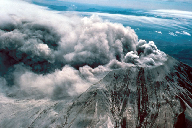
By early May 19, the devastating eruption was over.
 Live Science Plus


