Live Science Live Science
Sign in
  • View Profile
  • Sign out
RSS
  • Sign up to our newsletter Newsletter
    • Space
    • Health
    • Planet Earth
    • Animals
    • Archaeology
    • Physics & Math
    • Technology
    • Human Behavior
    • Chemistry
    • More
      • Science news
      • Opinion
      • Life's Little Mysteries
      • Science quizzes
      • Crossword
      • About us
      • Newsletters
      • Follow us
      • Story archive
    Trending
    • 'De-extinction' of giant ancient bird
    • New treatment for high cholesterol
    • Perseids meteor shower
    • Back up system for AMOC
    • Science news this week
    Recommended reading
    A satellite photo shows a glowing lava river flowing down the side of Mount Etna as a plume of ash and gas is released from its other side
    Volcanos 'River of fire' flows from Mount Etna during 'crazy' explosive outburst
    A satellite photo of an island with a giant river of orange lava
    Volcanos 'River of fire' unleashes toxic gases as eruption destroys town in La Palma
    A photograph of a large plume of smoke rising above the North Rim of the Grand Canyon National Park
    Wildfires Grand Canyon Dragon wildfire burns down historic lodge and triggers toxic gas leak
    A satellite photo of a large orange dust cloud over the ocean along the coast of West Africa
    Weather Giant 'Saharan dust' plume swirls around Africa a week before it hit Florida
    Looped slideshow of two satellite photos showing Las Vegas in 1999 and 2004
    Planet Earth Final photo from iconic US satellite shows how Las Vegas has 'doubled' in size over the last 25 years
    A satellite photograph of the Ingram Dam on July 8, after the flooding.
    Flooding Texas flood devastation revealed in before-and-after satellite images
    A photograph of the Mount Etna eruption ash cloud rising above Catania.
    Volcanos Mount Etna eruption in images: See Europe's largest active volcano blow from different angles
    1. Space
    Space.com

    California's Caldor Fire seen from space in harrowing satellite images (gallery)

    News
    By Christine Lunsford published 2 September 2021

    It's one of the biggest fires in California history.
    When you purchase through links on our site, we may earn an affiliate commission. Here’s how it works.

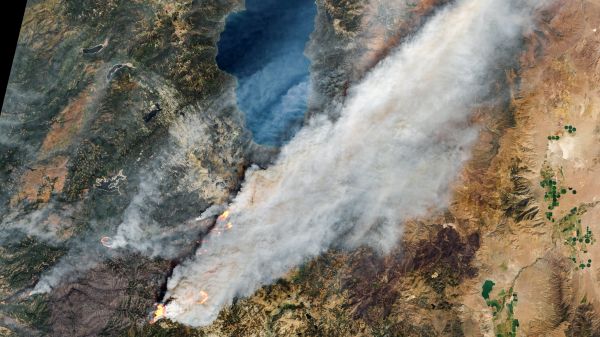
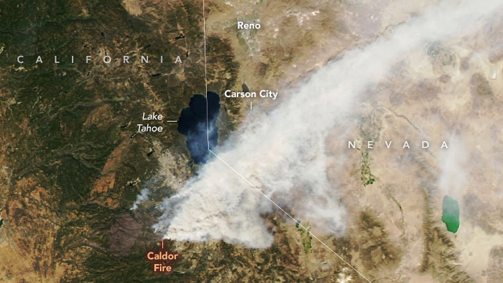
    Caldor Fire nears Lake Tahoe

    Caldor Fire nears Lake Tahoe

    The Caldor Fire, one of the largest in California's history, has been blazing in El Dorado County since Aug. 14, 2021. 

    It has since burned more than 200,000 acres of land and is now progressing toward the border of Nevada, near Lake Tahoe, according to the California Department of Forestry and Fire Protection. See satellite images of the growing fire in this Space.com gallery. 

    The image above, captured Aug. 30 by NASA's Aqua satellite, shows smoke from the Caldor Fire encroaching on the southern portion of Lake Tahoe. 

    Related: Record temperatures, fire clouds and drought ravage Earth in 2021

    Page 1 of 12
    Page 1 of 12
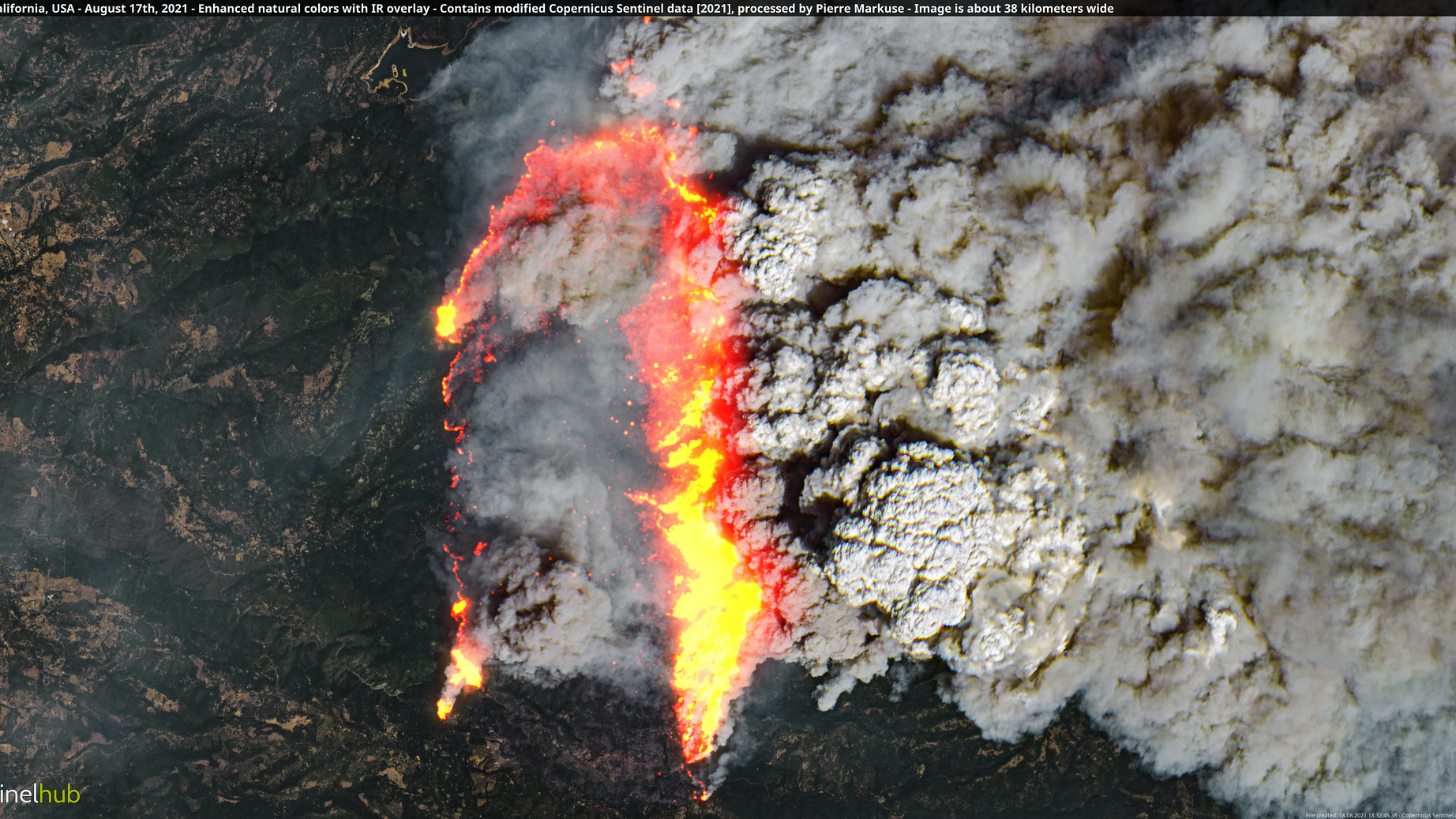
    Caldor Fire on Aug. 17

    Caldor Fire on Aug. 17

    An early view of the Caldor Fire, captured Aug. 17, shows the flames and smoke cutting across the dry California landscape. At the time, the fire was about 24 miles (38 kilometers) wide.

    Page 2 of 12
    Page 2 of 12
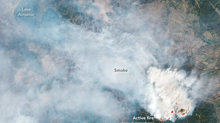
    Caldor Fire on Aug. 30

    Caldor Fire on Aug. 30

    NOAA's GOES 17 satellite captured this image of the raging Caldor Fire on Aug. 30, 2021. The Caldor Fire had scorched nearly 200,000 acres of forest and land as of Aug. 31, 2021. Residents of towns near South Lake Tahoe were evacuated as the blaze spread.

    Full story: Satellite tracks vicious Caldor Fire spread in California in time-lapse video
    Page 3 of 12
    Page 3 of 12
    The Dixie Fire is still burning, too.

    The Dixie Fire is still burning, too.

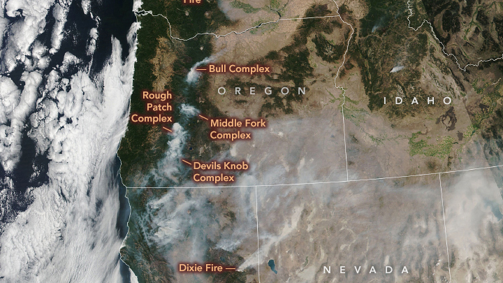
    Meanwhile, as the Caldor Fire has taken the spotlight, another fire is raging in Northern California. The second-largest Californian fire on record — the Dixie Fire —continues to burn has burned over 800,000 acres since July 13, 2021. This image from NASA's Landsat 8 satellite shows smoke from the Dixie Fire on Aug. 28, 2021, blanketing the region north of the Caldor Fire.

    Related: Satellite photos show Dixie Fire's devastation to California town in before-and-after views
    Page 4 of 12
    Page 4 of 12
    More fires blaze to the north

    More fires blaze to the north

    Air quality across the western United States is posing risks to people due to the Caldor, Dixie and other fires. In this image, captured Aug. 29 by the NASA-NOAA Suomi NPP satellite, nine fires are seen burning across multiple western states.

    Related: North America is surrounded by 4 storms and wildfire smoke in this satellite view
    Page 5 of 12
    Page 5 of 12
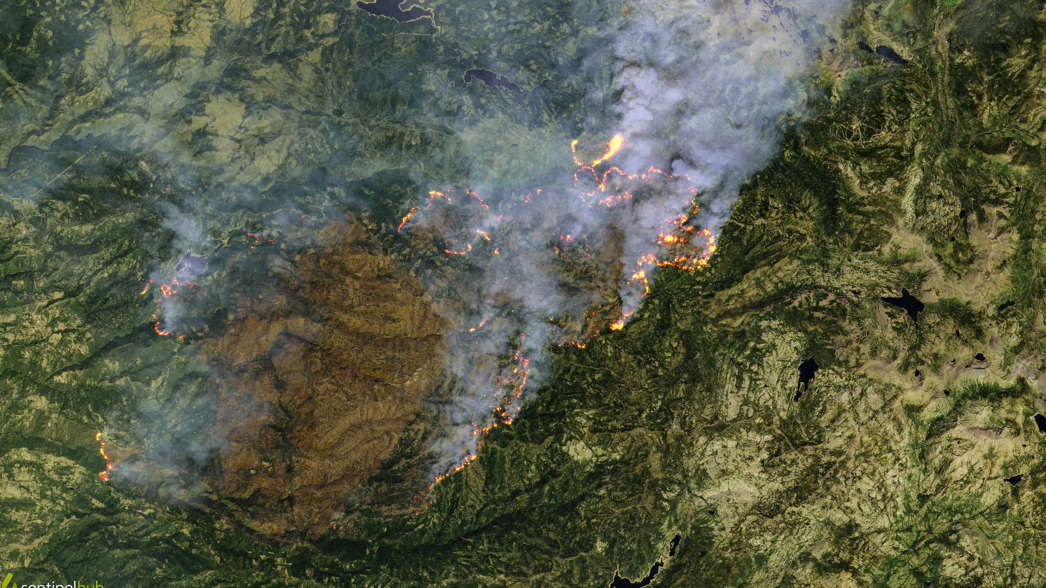
    Caldor Fire on Aug. 29

    Caldor Fire on Aug. 29

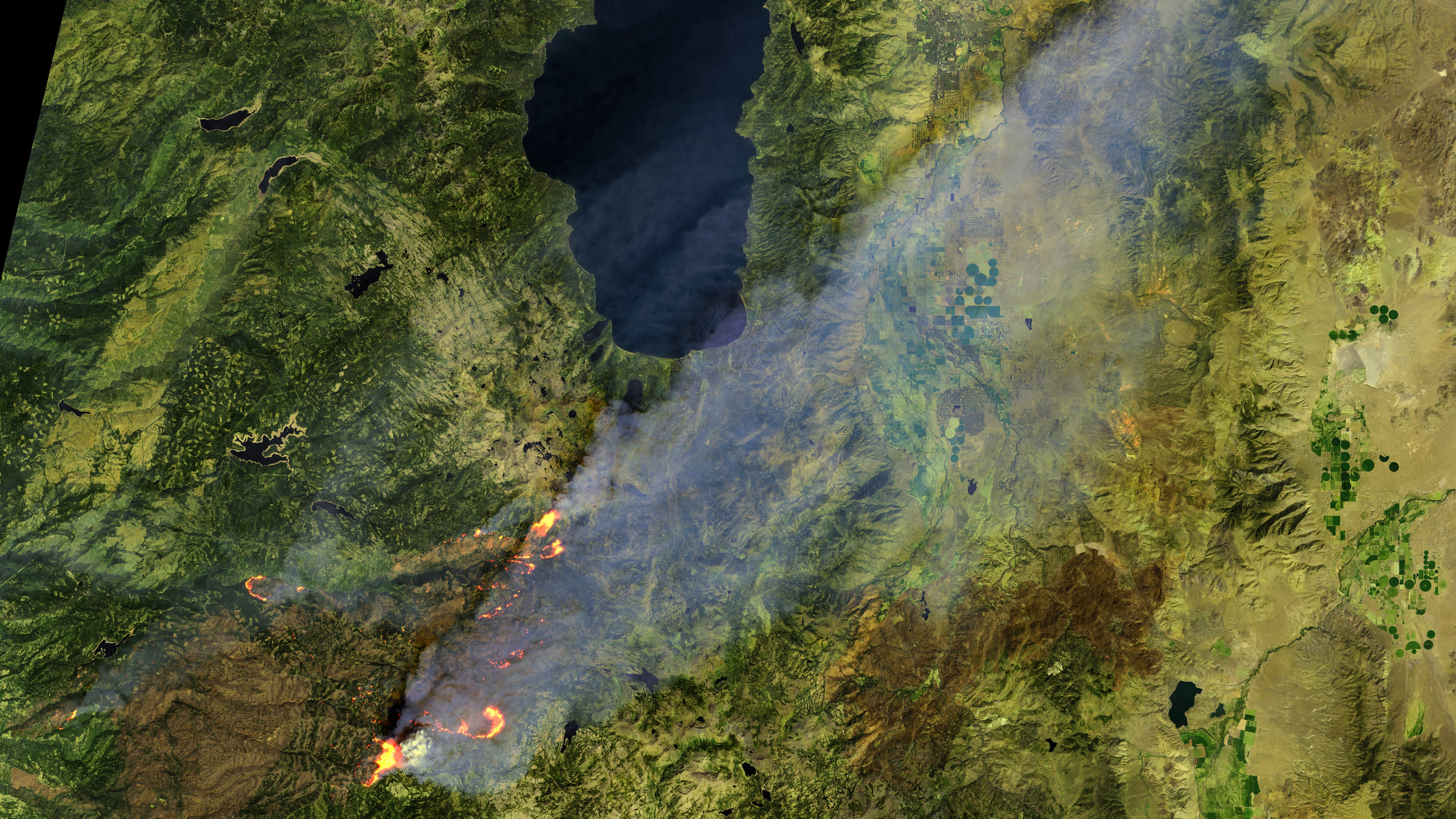
    South of Lake Tahoe in California, the Caldor Fire continues to burn, spewing smoke across the region. This image was processed by citizen scientist Pierre Markuse using data aquired by the European Space Agency's Copernicus Sentinel mission on Aug. 29, 2021. 

    Page 6 of 12
    Page 6 of 12
    Caldor Fire on Aug. 29

    Caldor Fire on Aug. 29

    In this satellite image aquired on Aug. 29, 2021, the Caldor Fire's smoke plume veils the region south of Lake Tahoe.

    Page 7 of 12
    Page 7 of 12
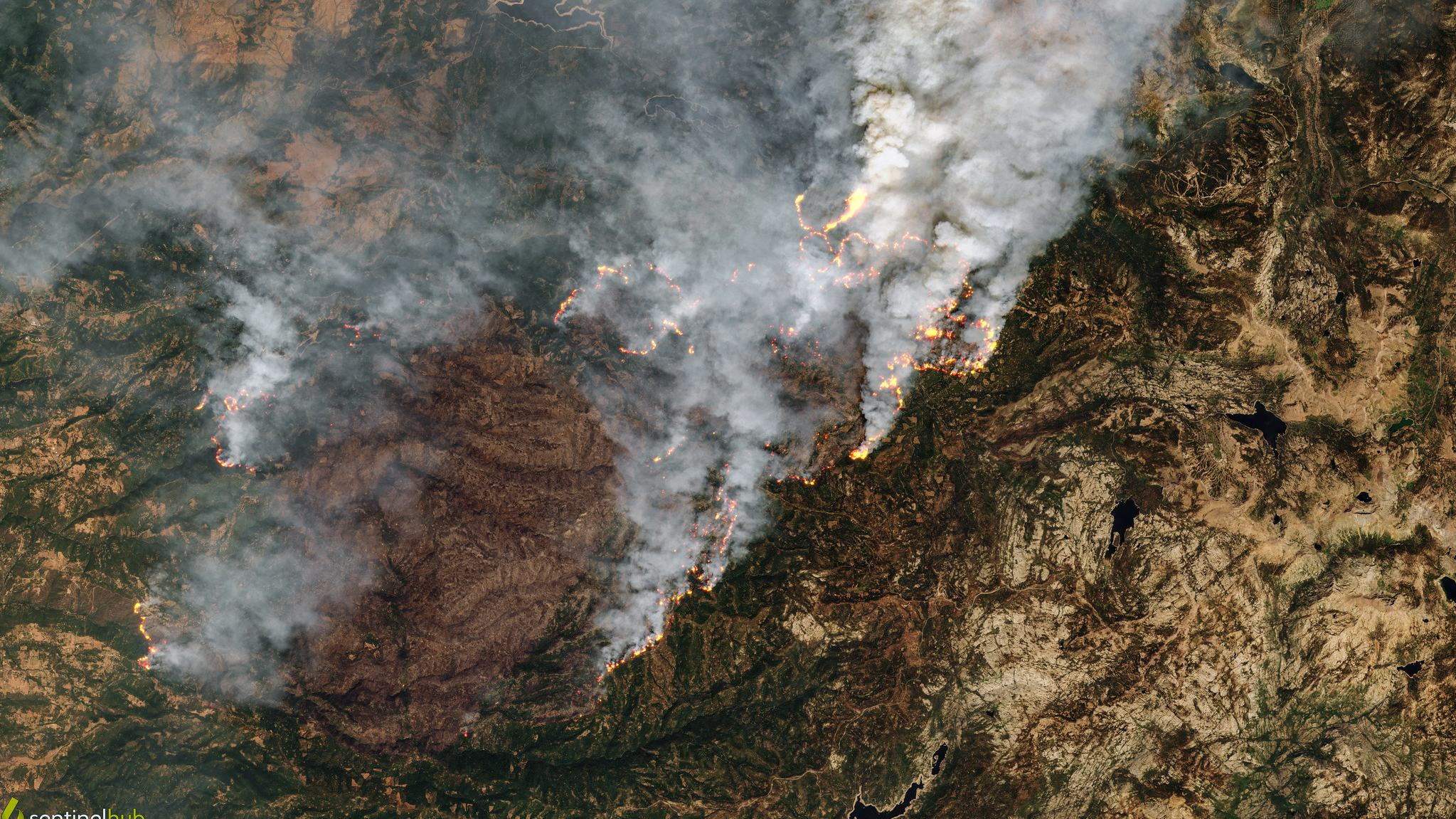
    Caldor Fire on Aug. 24

    Caldor Fire on Aug. 24

    On Aug. 24, 2021, the Caldor Fire continues to burn across the region south of Lake Tahoe. 

    Page 8 of 12
    Page 8 of 12
    Caldor Fire on Aug. 24

    Caldor Fire on Aug. 24

    The Caldor Fire, burning just south of Lake Tahoe, broke out on Aug. 14, 2021, and was only 20% contained as of Sept. 1. This image was processed by citizen scientist Pierre Markuse using data aquired by the European Space Agency's Copernicus Sentinel mission on Aug. 24, 2021.

    Page 9 of 12
    Page 9 of 12
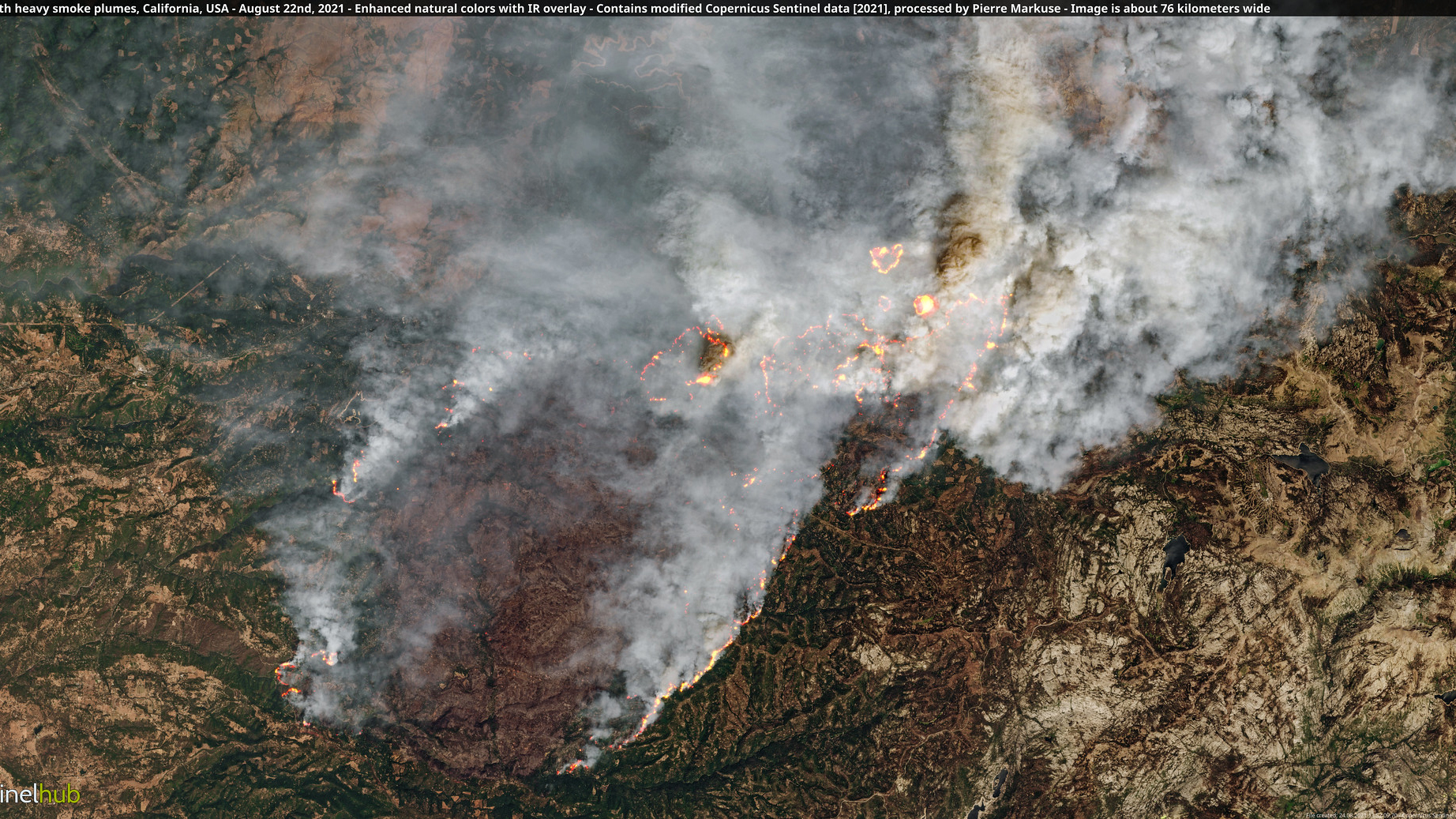
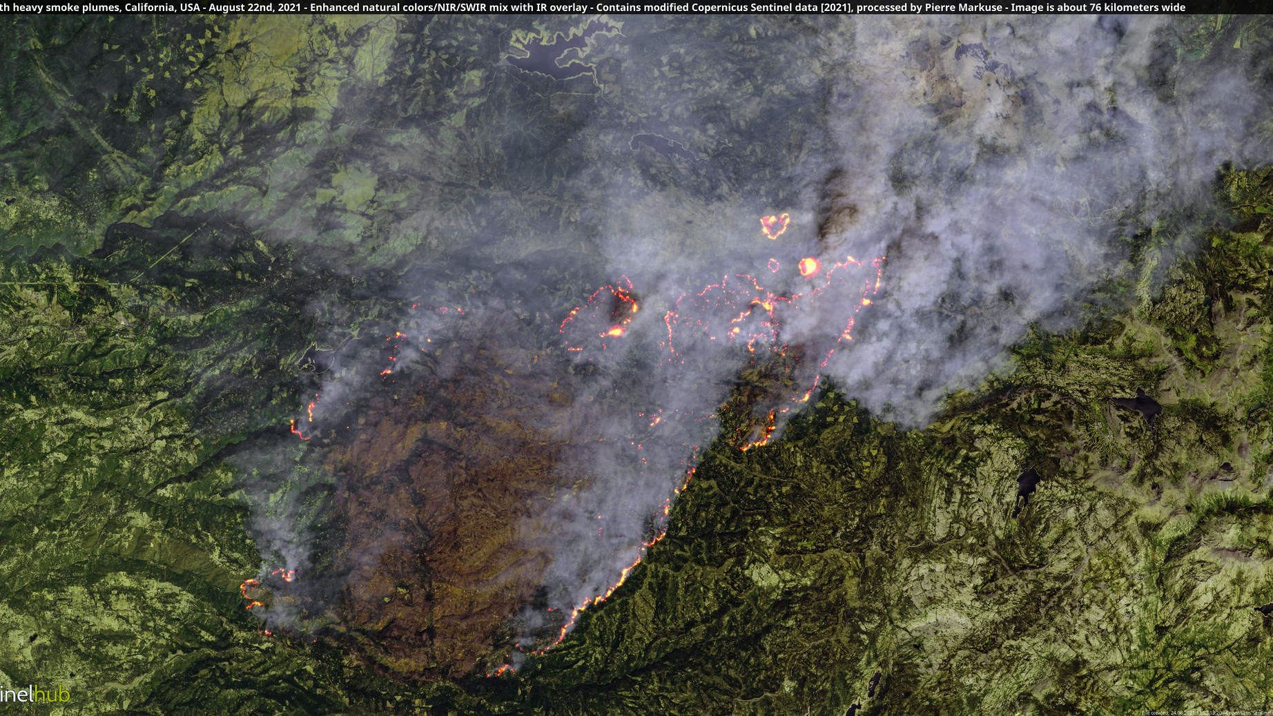
    Caldor Fire on Aug. 22

    Caldor Fire on Aug. 22

    As of Aug. 22, 2021, the Caldor Fire was blanketing the area with thick smoke as well as forcing residents in its path to flee.

    Page 10 of 12
    Page 10 of 12
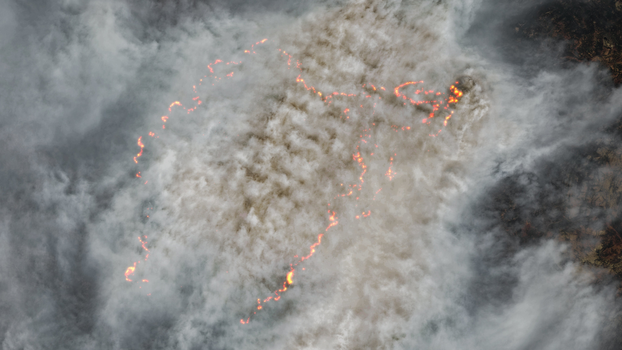
    Caldor Fire on Aug. 22

    Caldor Fire on Aug. 22

    Strong winds and low humidity pushed the Caldor Fire to spread over the ridge of the Sierra Nevada mountain range. Several more California counties had to be evacuated because of the spread.

    Page 11 of 12
    Page 11 of 12
    Caldor Fire on Aug. 19

    Caldor Fire on Aug. 19

    Smoke and clouds above and around the Caldor Fire block views of the ground almost completely. This enormous fire began August 14, 2021 and as of August 31, has scorched just over 190,000 acres.

    Page 12 of 12
    Page 12 of 12
    CATEGORIES
    Planet Earth
    Christine Lunsford
    Read more
    A satellite photo shows a glowing lava river flowing down the side of Mount Etna as a plume of ash and gas is released from its other side
    'River of fire' flows from Mount Etna during 'crazy' explosive outburst
    A satellite photo of an island with a giant river of orange lava
    'River of fire' unleashes toxic gases as eruption destroys town in La Palma
    A photograph of a large plume of smoke rising above the North Rim of the Grand Canyon National Park
    Grand Canyon Dragon wildfire burns down historic lodge and triggers toxic gas leak
    A satellite photo of a large orange dust cloud over the ocean along the coast of West Africa
    Giant 'Saharan dust' plume swirls around Africa a week before it hit Florida
    Looped slideshow of two satellite photos showing Las Vegas in 1999 and 2004
    Final photo from iconic US satellite shows how Las Vegas has 'doubled' in size over the last 25 years
    A satellite photograph of the Ingram Dam on July 8, after the flooding.
    Texas flood devastation revealed in before-and-after satellite images
    Latest in Space
    an illustration of Venus
    Venus news, features and articles
    an illustration of Uranus
    Uranus news, features and articles
    Three black and white images of wispy material each with an arc shape outlined in a yellow dotted line
    Parker Solar Probe captures closest-ever photos of the sun during record-breaking flight
    Looped video footage showing the location of the comet in a moving starscape
    Astronomers are racing to study our solar system's newest 'interstellar visitor.' Here's why.
    a photo of blue and orange cloudy shapes in outer space with countless twinkling stars
    James Webb and Hubble telescopes join forces to explore a cosmic nursery: Space photo of the week
    A blurry picture of stars with arrows pointing to where a comet is
    3I/ATLAS: Everything you need to know about the new 'interstellar visitor' shooting through the solar system
    Latest in News
    A photograph of a large plume of smoke rising above the North Rim of the Grand Canyon National Park
    Grand Canyon Dragon wildfire burns down historic lodge and triggers toxic gas leak
    an illustration of a strand of DNA
    'Epigenetic memory' may help explain why PCOS tends to run in families
    a rock carving of people and a boat
    Ancient Egyptian rock art discovered near Aswan may be from the dawn of the first dynasty
    an illustration of cholesterol in the bloodstream
    Experimental treatment for high cholesterol edits DNA in the body to reduce LDL
    A microscope image of a PGA, a lab-grown model of an amniotic sac, depicted in magenta and yellow
    Scientists grow mini amniotic sacs in the lab using stem cells
    a bat hanging upside down from a branch
    Man in Australia dies of rare, rabies-like disease
    LATEST ARTICLES
    1. A photograph of a large plume of smoke rising above the North Rim of the Grand Canyon National Park
      1
      Grand Canyon Dragon wildfire burns down historic lodge and triggers toxic gas leak
    2. 2
      Roman dodecahedron: A mysterious 12-sided object that has baffled archaeologists for centuries
    3. 3
      Japan sets new internet speed record — it's 4 million times faster than average US broadband speeds
    4. 4
      Can your brain run out of memory?
    5. 5
      Could signs of Mars life be hidden in its thick layers of clay?

    Live Science is part of Future US Inc, an international media group and leading digital publisher. Visit our corporate site.

    • About Us
    • Contact Future's experts
    • Terms and conditions
    • Privacy policy
    • Cookies policy
    • Accessibility Statement
    • Advertise with us
    • Web notifications
    • Careers
    • Editorial standards
    • How to pitch a story to us

    © Future US, Inc. Full 7th Floor, 130 West 42nd Street, New York, NY 10036.

    Please login or signup to comment

    Please wait...