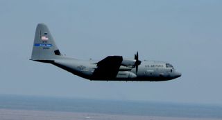
WATCH: Harrowing Flight into Irma Captured in Time-Lapse Video
Footage shot by USAFR pilot Maj. Kendall Dunn and shared on Twitter and Facebook on Sept. 6 shows the view from the cockpit of their aircraft — a WC-130J Super Hercules — as the squadron navigates through Irma. At the time, the hurricane was a Category 5 storm, with maximum sustained winds of 185 mph (298 km/h). [Inside Irma's Eye: Hurricane Hunters Capture Jaw-Dropping Photos]
The Hurricane Hunters are part of the 403rd Wing, a USAFR unit that oversees airborne missions related to weather. The team works with the National Hurricane Center (NHC) to sample data from powerful storms in the Atlantic Ocean, flying aircraft through hurricanes, and dropping special devices that measure the storm's winds, moisture and air pressure.
A Hurricane Hunters' mission, which typically lasts between 8 and 12 hours, makes several passes through the storm's eye to gather data using an instrument called a dropsonde, Staff Sgt. Heather Heiney, a USAFR representative, told Live Science.

Dropsondes are small, biodegradable, cylindrical devices that contain sensors, a GPS receiver and a radio transmitter. They are dropped from aircraft and gather atmospheric and meteorological data during their descent, which they transmit remotely back to the aircraft, according to the National Center for Atmospheric Research.
Hurricane Hunters fly through tropical storms and hurricanes at an altitude of approximately 10,000 feet (3,048 meters). They pass through the eye of the storm up to six times to pinpoint its low-pressure center and deploy the dropsondes, according to a USAFR statement.
Once the data from the dropsondes is transmitted back to the aircraft, the Hurricane Hunters use satellite communication to send the data to the NHC on the ground to help them analyze the storms and assess their risks, improving the accuracy of predictions by an estimated 20 percent, the USAFR reported.
"It's important to be prepared," Maj. Ryan Rickert, an aerial reconnaissance weather officer with the USAFR, said in the statement. "It's why we do this, so we can have better forecasts and people have time to prepare and evacuate," he added.
Sign up for the Live Science daily newsletter now
Get the world’s most fascinating discoveries delivered straight to your inbox.
Original article on Live Science.

Mindy Weisberger is an editor at Scholastic and a former Live Science channel editor and senior writer. She has reported on general science, covering climate change, paleontology, biology, and space. Mindy studied film at Columbia University; prior to Live Science she produced, wrote and directed media for the American Museum of Natural History in New York City. Her videos about dinosaurs, astrophysics, biodiversity and evolution appear in museums and science centers worldwide, earning awards such as the CINE Golden Eagle and the Communicator Award of Excellence. Her writing has also appeared in Scientific American, The Washington Post and How It Works Magazine.

