
-
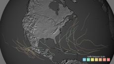
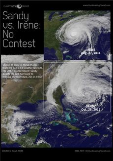 Storm Size Comparison: Irene vs. Sandy (Infographic)
Hurricane Irene was a billion-dollar disaster, but it is dwarfed in terms of size by Hurricane Sandy.
-
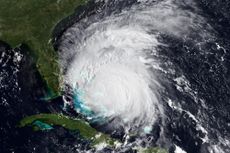 Goodnight, Irene! Destructive Hurricane's Name Retired
Hurricane Irene caused billions in damage when it struck in August 2011.
-
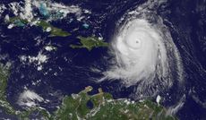 Name That Hurricane: Famous Examples of the 5 Hurricane Categories
There are five categories of hurricanes based on their windspeed. Here is one example of each type of storm.
-
 Wild Weather of 2011: Blame La Niña
From floods to fires to tornadoes, records fell while damage mounted.
-
 2011 Tally of Billion-Dollar Weather Disasters Hits 12
June tornado outbreak and Southwest wildfires are latest additions.
-
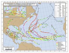
 Active 2011 Hurricane Season Comes to an End
Irene reminds the Northeast of its vulnerability to hurricanes.
-
 Warm Ocean Water Keeps Hurricanes at Bay, Study Finds
In two active hurricane seasons, only one storm has hit U.S.
-
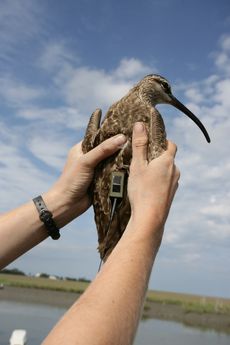 Whimbrels Migrate Thousands Of Miles, Only To Be Gunned Down
Tracked shorebirds navigate through storms only to be killed by hunters.
-
 Leaf Forecast: Outlook Good for Colorful Fall
Hurricane Irene may add kick to fall's colorful leaves.


