Here We Go Again: Like Wolves, Hurricanes Come in Packs

"It doesn't matter what the numbers are. It only takes one hurricane to ruin your year, a whole lot." -- Frank Lepore, National Hurricane Center
Like holiday travelers or wolves, hurricanes travel in packs, and this summer is expected to generate more monsters from the same deadly pack that rattled nerves in Florida and much of the East Coast in 2004.
It all begins again June 1, officially, so buckle up.
In recent years, scientists have learned that hurricane activity waxes and wanes on a cycle that last decades. We're in the middle of the busy stretch now.
A veteran forecasting group at Colorado State University predicted seven Atlantic-basin hurricanes for this season, which runs through Nov. 30. Today, the group updated its prediction to eight hurricanes. A similar forecast by NOAA's National Hurricane Center calls for up to nine.
Either way, it's likely to be an "above average" year, coming on the heels of one of the worst U.S. hurricane seasons on record when nine hurricanes formed and four struck Florida last August and September, traditionally the busiest months.
The Atlantic basin includes the Caribbean and the Gulf of Mexico.
Sign up for the Live Science daily newsletter now
Get the world’s most fascinating discoveries delivered straight to your inbox.
"Eight of the ten last seasons have been very active" in this region, said Gerry Bell, lead scientist for NOAA's seasonal hurricane outlook. "Contrast that to the '70s, '80s, and (early) '90s, when we only had three seasons above-normal activity."
'Completely different'
"It's a completely different climate regime that we are in," Bell told LiveScience. "As a result, we're having these above-normal hurricane seasons."
Scientists are better than ever at diagnosing and predicting hurricane patterns, but it's still weather forecasting, so there's room to grow.
These days, NOAA scientists focus on many global climate factors, some of which are as far away from the Atlantic as you can get. The Pacific El Nino and its cooler sister La Nina are crucial, as is another complex ocean pattern called the multi-decadal signal.
Both are cyclical, especially the multi-decadal signal, which comes and goes not across years, but across multiple decades.
"The bottom line is that hurricane activity is controlled by a global system," said Bell, who helps with the NOAA National Hurricane Center's annual forecast. "If you can predict the global activity, you can predict the hurricane outlook."
The big picture
The Colorado State team also takes a global view of things. Their forecast trades on global climate trends going back 52 years.
"This is a valid methodology provided the atmosphere continues to behave in the future as it has in the past," the team's leader William Gray wrote in the latest forecast for the 2005 season. "We have no reason for thinking that it will not."
Predictors for the Colorado State statistical forecast include unusual winds off the northeast coast of South America and in the southern Indian Ocean, pressure in the Southeast Pacific Ocean, sea surface temperatures off the northwest coast of Europe, and low pressure in the Gulf of Mexico.
Four hurricane seasons match the current conditions setting the stage for this hurricane season--1952, 1959, 1995, and 2003. The average number of hurricanes in each of those years was 7.8.
Global warming had little to do with the punishing 2004 hurricane season, Gray and his colleagues say. Florida alone was pummeled by hurricanes Charley, Frances, Ivan, and then Jeanne. By the time the wind stopped whistling, 2004 totaled nine hurricanes, six of which were major storms with winds exceeding 110 mph.
But if global warming were the cause of the increase in U.S. hurricane landfalls last far, there should have been higher-than-normal numbers of hurricanes or typhoons in other tropical basins worldwide, such as the West Pacific, East Pacific, and Indian Ocean. There weren't.
Predicting paths
It's one thing to say how many hurricanes are coming this summer. It's another to predict the path of an incoming individual tropical cyclone--that's the technical term for hurricanes and typhoons (typhoons are hurricanes that develop in the northwestern Pacific Ocean).
A supercomputer named Columbia at NASA's Ames Research Center in California, using a model developed by scientists at NASA Goddard Space Flight Center and other institutions, has done a very good job of predicting, sight unseen, the erratic paths of Hurricanes Gustav and Isidore (2002) and Bonnie and Charley (2004).
It takes just over an hour for 240 of the supercomputer's processors to crunch an enormous amount of data to yield a 5-day forecast for a specific hurricane, with new location predictions for every six hours.
The approach, which took 10 years to develop, allowed a team of scientists to simulate these hurricanes' paths and prominent features based on initial global winds and pressure data with a resolution of up to 15 miles (previous methods had a resolution of 30 miles).
Hurricanes can bedevil forecasters by making landfall hundreds of miles away from where they are expected, however. Or they can head back out to sea and pick up strength before returning to strike land again. Sometimes they defy all logic and curve back on their old paths.
Scientists like to describe the "structure" of a hurricane, including its warm, central vertical column of weak wind (the eye) and its rotation. All this plays back into tracking forecasts.
The path-predicting scientists, including Oreste Reale at NASA Goddard, were able to reproduce, in most cases, the paths, intensity, wind speed, temperature, and rotational qualities of these four hurricanes, chosen for their strange behavior. For instance, Charley was right on Bonnie's heels and pushed her east, the scientists show. The research was published in Geophysical Research Letters.
Sideways glance
The focus in this new model is on the horizontal movement of water vapor, which controls not just rain but the overall energy in the atmosphere that powers a hurricane.
In the future, the scientists hope to improve their predictions by using satellite weather data.
Hurricanes once took humans by surprise. In 1900, a catastrophic hurricane unexpectedly hit Galveston Texas, killing more than 6,000 people. Nowadays, weather satellites and computer models detect hurricanes in advance.
"The problems forecasters are facing at this time are trying to predict the track more accurately, to have a good estimate of the landfall point, and to predict the intensity changes," Reale told LiveScience.
Forecasters also tend, today, to predict things will be worse than they turn out, Reale said. This leads to unnecessary evacuations. In the future, scientists hope to learn to correct for overforecasting.
Numbers, Schnumbers
National Hurricane Center spokesman Frank Lepore takes a pragmatic view of hurricane prediction.
"These numbers are scientifically interesting," Lepore said in a telephone interview. "It doesn't matter what the numbers are. It only takes one hurricane to ruin your year, a whole lot."
A "below average" season was forecast for 1992. That's when Hurricane Andrew struck the coast of Florida, eventually costing the nation $30 billion.
Nearly a third of all Floridians and nearly half of all Americans have no hurricane preparedness plan, according to a recent survey. Forecasters hope that residents pay attention to news reports when storms brew, and that they follow advice to evacuate when necessary.
When a storm approaches, all the pre-season prognosticating becomes pretty irrelevant, and concern for property often gives way to worries about life and death.
"We try to keep people focused on the one storm," Lepore said.
Related Stories
- 2005 Hurricane Season Guide
- How & Where Hurricanes Form
- Top 10 Ways to Destroy Earth
Complete Coverage A review of 2004, forecast for 2005, plus the science, facts and numbers behind nature's greatest storms. Go >>>
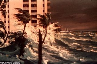
Image Gallery
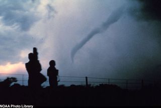
Image Gallery

Hurricane Galleries


Robin Lloyd was a senior editor at Space.com and Live Science from 2007 to 2009. She holds a B.A. degree in sociology from Smith College and a Ph.D. and M.A. degree in sociology from the University of California at Santa Barbara. She is currently a freelance science writer based in New York City and a contributing editor at Scientific American, as well as an adjunct professor at New York University's Science, Health and Environmental Reporting Program.
Most Popular


