Deadly Tornadoes, Floods Blamed on 'Superjet' Stream

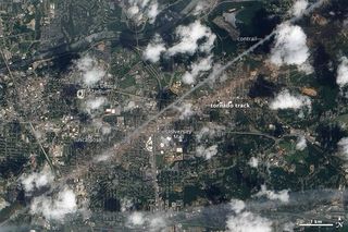
A rare 'superjet' stream may have caused the devastating outbreak of tornadoes in April of this year and the extensive flooding in western Tennessee in 2010, new research suggests.
The flooding and deadly tornado outbreak seem to be linked to a relatively rare coupling between the polar and the subtropical jet streams, said Jonathan Martin, an atmospheric scientist at the University of Wisconsin-Madison who will present his work at the annual meeting of the American Geophysical Union in San Francisco this week (Dec. 6 and 7). This kind of jet-stream mash-up could become more common due to global warming, Martin and his colleagues say.
The coupling happened in the western Pacific, about 9,000 miles (14,500 kilometers) away from the intense storms in the U.S. midsection, Martin said. The jet-stream merge begins when organized complexes of tropical thunderstorms over Indonesia push the subtropical jet stream north, causing it to merge with the polar jet stream.
The subtropical jet stream is a high-altitude band of wind that is normally located around 30 degrees north latitude. The polar jet stream is normally hundreds of miles to the north.
Martin calls the resulting combined band of wind a "superjet." [Infographic: Atmosphere Top to Bottom]
Anatomy of a superjet
Jet streams in the northern hemisphere blow from the west at roughly 140 mph (225 kph), and are surrounded by a circular whirlwind that looks something like a tornado pushed on its side. The circulating wind at the bottom of the jet stream blows from the south. On the north side, the circulating winds turn vertical, lifting and cooling the air until the water vapor condenses and feeds precipitation.
Sign up for the Live Science daily newsletter now
Get the world’s most fascinating discoveries delivered straight to your inbox.
A superjet and its circulating winds can carry double the energy of a typical jet stream, Martin said. When these usually separate jet streams sit atop one another, a very strong vertical circulation can create clouds, precipitation and tornadoes.
And because the circulating wind in a superjet moving across the southern United States picks up moisture from the Gulf of Mexico, "the superjet gives a double whammy — more moisture and more lifting, producing that intense rain," Martin said.
That was the case in May 2010, when 10-to-20 inches (25-to-50 centimeters) of rain fell around Nashville, Tenn.
The super-strong jet stream "could be traced back to conditions in the western Pacific almost a week earlier," said Andrew Winters, a graduate student studying with Martin.
Global connections
Studies of the Tennessee floods, the Alabama tornadoes and an odd October storm in Wisconsin showed "that when the subtropical jet is pushed poleward under the influence of strong thunderstorms in the western Pacific, it seems to result in these intense storms in the U.S. midsection," Martin said. "It's a really fascinating global connection that occurs seven-to-10 days later."
Martin also suggests the altered position of the subtropical jet stream may be linked to global warming.
"There is reason to believe that in a warmer climate, this kind of overlapping of the jet streams that can lead to high-impact weather may be more frequent," Martin said.
Follow OurAmazingPlanet for the latest in Earth science and exploration news on Twitter @OAPlanet and on Facebook.
Most Popular


