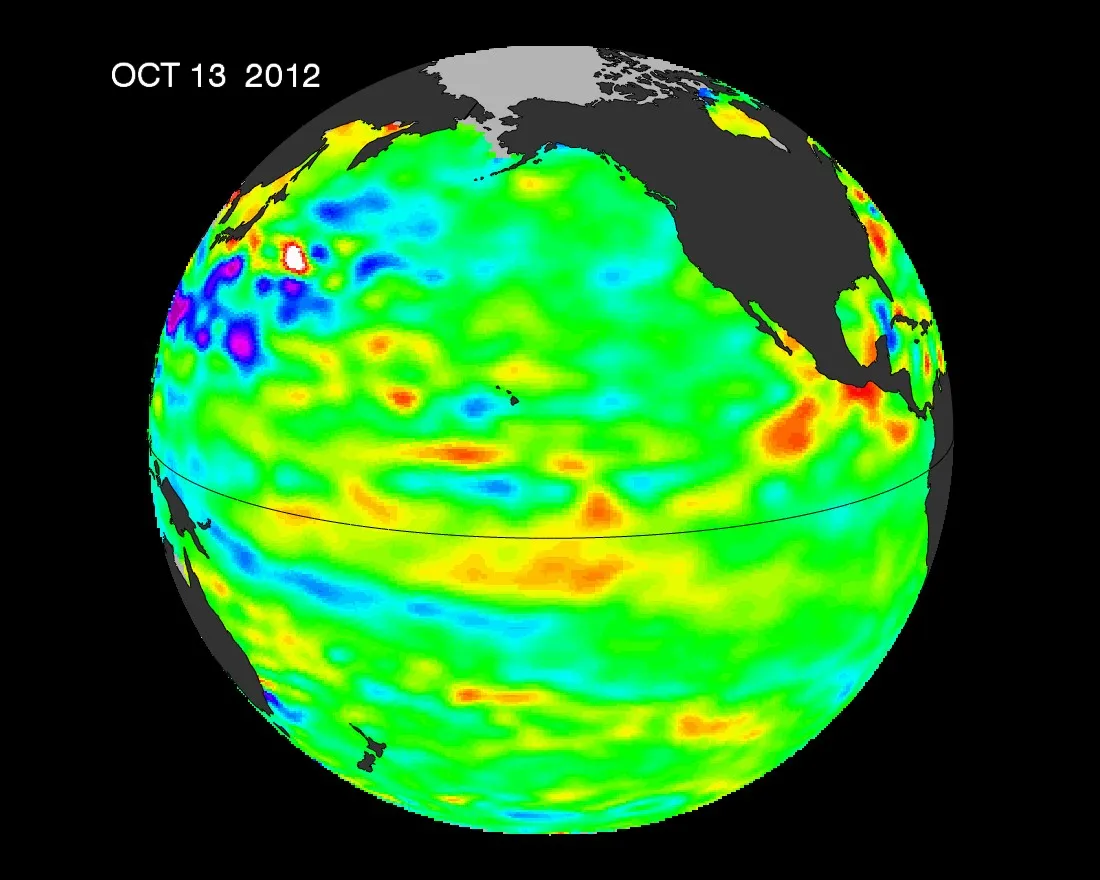
Adios, El Niño. Forecasters have called off predictions for a wet winter in the West, finally acceding that ocean temperatures in the Pacific show no signs of the infamous El Niño phenomenon.
Weather experts at the Climate Prediction Center (CPC) first warned of developing El Niño conditions in June. An El Niño is the warming of the equatorial Pacific Ocean, which results in major droughts in Southeast Asia and wet winters for the southwestern United States. In a boon for the battered Northeast, an El Niño would have meant less wintry weather there.
But in the following months, sea-surface temperatures failed to warm enough to shift global weather patterns. In early October, the CPC dropped the odds of an El Niño from 70 percent to 55 percent.
Latest Videos From
Finally, the CPC, part of the National Oceanic and Atmospheric Administration (NOAA), called off the El Niño forecast Thursday (Nov. 9). "The previous El Niño watch has been discontinued as the chance of El Niño has decreased," the CPC said yesterday in its monthly report.
While the chances of El Niño seem nil, the CPC said tropical ocean temperatures may still remain above average.
Instead of El Niño, NOAA predicts that the neutral phase of the El Niño/ La Niña Southern Oscillation (ENSO)index will prevail. Jokingly called "La Nada," it is the neutral middle ground between El Niño and La Niña (associated with cool water in the equatorial Pacific).
El Niño expert Bill Patzert first pegged the La Nada back in June. "The equatorial Pacific is neutral, with no El Niño developing... not even a hint," said Patzert, of the Jet Propulsion Laboratory in Pasadena, Calif., in June. Even as ocean temperatures warmed slightly, Patzert said he maintained the call.
"The atmospheric support never developed, and I was saying weak El Niño maybe, but basically La Nada," Patzert told OurAmazingPlanet in an email. "I wanted an El Niño, but I just couldn't make it happen."
La Nada makes storms more difficult to predict. Without ENSO'sinfluence on storm patterns, forecasters lack a predictable guide for winter temperature and precipitation throughout the United States. For example, El Niño means more rain and snow in the south and the phenomenon even calms hurricanes in the Atlantic.
Reach Becky Oskin at boskin@techmedianetwork.com. Follow her on Twitter @beckyoskin. Follow OurAmazingPlanet on Twitter @OAPlanet. We're also on Facebook and Google+.

 Live Science Plus