Storm Train Continues in Southern Alaska

This article was provided by AccuWeather.com.
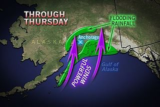
More storms are taking aim at Anchorage and the southern coast of Alaska into the last week of September.
During September, storms typically become stronger and more frequent over Alaska, especially near the southern coast, and this September's pattern is living up to climatology and then some.
Typically, the storm track migrates from northern areas toward the southern coast this time of the year, but amplified upper atmospheric steering currents, known as the jet stream, are giving storms a boost.
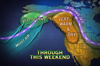
A high amplitude jet stream pattern, responsible for warm, dry conditions over the Northwest United States and western Canada, is allowing strong winds with the storms over Alaska.
According to World Weather Expert Jim Andrews, "The wind flow around the surface storms is lining up with upper-level winds at times, allowing strong gusts to affect portions of the southern coastline and nearby inland mountain ranges."

The pattern is also driving extra moisture in from the Pacific Ocean.
Sign up for the Live Science daily newsletter now
Get the world’s most fascinating discoveries delivered straight to your inbox.
"Since the storms are plowing in from the southwest, from the open Pacific, they can have an enhanced effect in the Prince William Sound region and in south-central Alaska in general, unloading extra rain and high country snow," Andrews said.
In the current pattern, one potent storm after another will roll northeastward, from the Pacific through at least the weekend.
A potent storm will affect the region Wednesday into Thursday. Yet another storm forecast to hit this weekend (Sept. 22-23).
However, while still strong, the storms moving forward through the end of the month may trend slightly less intense, when compared to the storm that rolled in last weekend (Sept. 15-16).
Late this month, the jet stream is forecast to flatten out a bit, allowing storms to roll along a more typical west to east path over southern Alaska and colder waters.
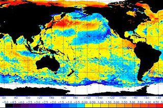
Extra warm water to the southwest, extending east of Japan, may be adding some extra energy to the current storm storm track.

Last September, much of Alaska was both drier and warmer than average. Slightly cooler and wetter conditions compared to average are affecting much of the state this September.
In Alaska, weather in one area can be vastly different in another area nearby, especially along the southern coastline.
Over southern Alaska's rugged terrain, wind direction is key as to how gusty and wet various locations are with each storm. There are tremendous elevation differences over short distances.
"Generally where the air blows uphill, those locations will be much wetter than in places where the air is racing downhill," Andrews stated.
© AccuWeather.com. All rights reserved. More from AccuWeather.com.
Most Popular

